Rant n' Rave – Piss n' Moan – rambles and rants of an old man…

June 29, 2009

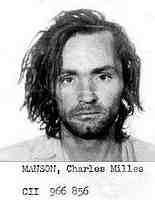
Charlie Manson and Me – part 8

Filed under: Charlie Manson and Me - part 8 — Bob @ 10:43 am

===========================

Charlie Manson and Me – part 8

~It’s All Downhill From Here~

===========================

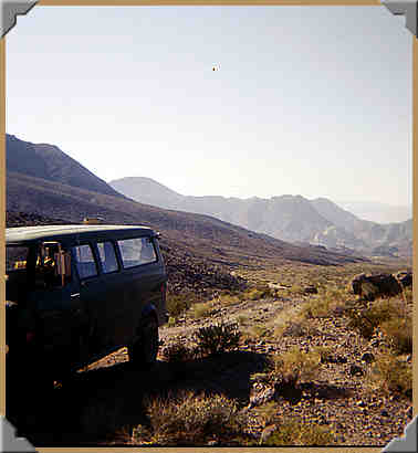
Next, we drove slowly by Striped Butte, heading Northward through the valley, looking for the trail to bear to the right somewhere past the middle of this valley we were in.  We didn’t even know the name of this Valley!  As we were told, the trail would eventually take us down into Death Valley.
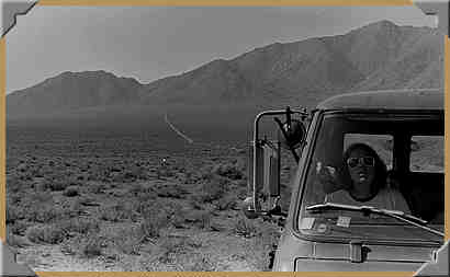
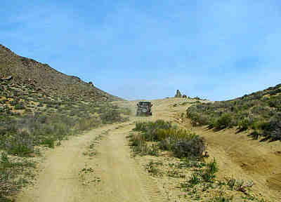
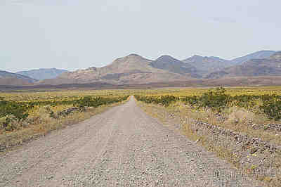
Butte Valley Rd. facing Southwest toward Manly Peak - 03/27/2005

Butte Valley Rd. facing Southwest toward Manly Peak – 03/27/2005

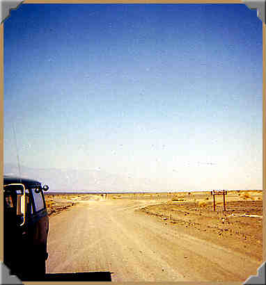
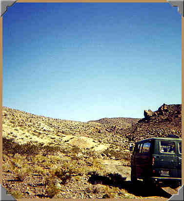
Trail leading Westward back to Mengel Pass - 10/1976.

Trail leading Westward back to Mengel Pass – 10/1976. Beside Striped Butte, looking Northward, the way we will head.

 There ahead, as in the picture above, the trail started curving around a mountain, heading in the direction we wanted to go, so we went!  The driving wasn’t too bad, just some washboard and some small rocks.  No biggie!  No regular grader passed through there back then, just a trail.

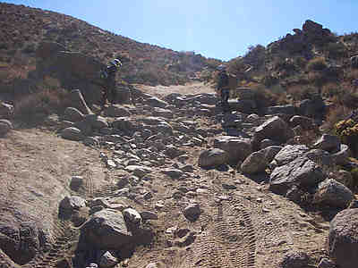
Then we headed in a more Easterly direction and the trail turned into pretty nasty fields of bowling-ball sized rocks.  I had to very slowly bounce over each obstacle, quietly praying that our high-mileage van would survive.  The sturdy I-beam front end was in very good shape, the shocks were fairly new, the tires were fine, and I had rebuilt the steering box about 6 months earlier.  I had also added a hydraulic steering stabilizer to help with the manual steering.  So if I just took ‘er easy, we SHOULD make it jes’ fine, I hope, I hope!

For what seemed like 800 or 1,000 agonizing miles, we bounced and toiled over those rocks, searching for smooth spots to ease the pressure on the van.  I recall that my hands were sore from their death-grip on the steering wheel.  I didn’t want to hook a finger around the wheel, as a sudden bump could have easily broken it!  All the while we were heading East and downhill, so at least we were getting somewhere, whatever THAT means!  LOL

Eventually we passed a talc mine that looked like it was being worked, and then a while later we passed another.  We didn’t stop to look around, as we were more concerned with surviving this leg of the trip into Death Valley than trespassing on someone’s mining claim.  We didn’t see any signs of life other than feral burros, or we would have stopped to make sure we were going in the right direction.

The road surface smoothed out a lot once we went by those mines, as they were heavily compacted by the regular traffic to and from the mines.

I have been looking for pictures of this stretch of our trip, but I haven’t found any but a few of the Warm Springs Mine.  I don’t recall seeing anyplace that invited our exploration, so we kept forging onward and downward toward our next ‘hurdle’, that aforementioned quicksand trap laying across the trail, keeping us from entering Death Valley proper.

Well, as luck would have it, and we obviously were being watched over that weekend, as we approached the top of the alluvial fan near the East end of Butte Valley Rd., we were much relieved to spot a big Caterpillar Grade-All! (Don’t remember if it was yellow or khaki brown.)
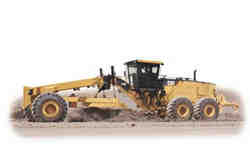
Caterpillar Grade-All

It was making its way to the East along the end of Butte Valley Rd. where it meets up with West Side Hwy., so our way was safe and clear.  We drove over the freshly graded trail, eyeing the 2 feet of wet sand moved aside by that wonderful grader!  We most-likely would  have fallen prey to that sand trap if we hadn’t been so kindly advised by the stranger back at the Barker Ranch.

It was nearing noontime, and rarely ever missing a meal, I drove Southeast a bit on West Side Hwy., and found an inviting spot to pull off the ‘beaten path’ and stop for lunch. (You can call me anything you like, but don’t call me late for lunch!  LOL) 

 
Junction of Butte Valley Rd. and West Side Hwy. - maybe? - 10/1976

Junction of Butte Valley Rd. and West Side Hwy. – maybe? – 10/1976


==========================

Charlie Manson and Me – part 9

~Lunch in Death Valley~

==========================

.


June 26, 2009

Charlie Manson and Me – part 4

Filed under: Charlie Manson and Me - part 4 — Tags: — Bob @ 5:23 pm
===========================
Charlie Manson and Me – part 4
~Up Goler Wash To The Barker Ranch~
===========================
Sunday morning, after a GREAT nights’ sleep, we awoke to another beautiful day.  After breakfasting (probably on bacon, eggs, toast, juice, etc.), we packed up all our stuff, leaving nothing but footprints behind, as was our usual plan.
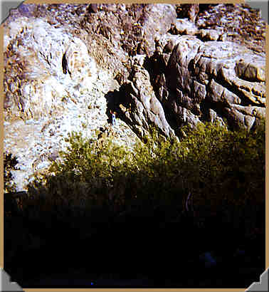
But first Danny and I did a bit of exploring.  We went across Goler Wash and climbed a bit of the North wall.  I think there was a mine up there, but we never made it up that high.
Up on the North wall of Goler Wash - 10/1979.

Up on the North wall of Goler Wash – 10/1979.

You can see me with the red shirt and denim cutoff in the center.  Danny was a bit lower and lost among the trees. *Sorry, Dan!*
Once we got back to the cabin, I went inside to leave a business card on the wall where many others were stuck, as a comment that ‘we were there’.  I think there was a ‘cabin log’ as well, which I would have signed, but I am not 100% sure about that.
Then we discussed what our plans for the day would be; head back West and go home?  Or go farther East up the Goler Wash on Coyote Canyon Rd. ‘to see what we could see’ (…to the tune of  ’The Bear Went Over The Mountain’)?  We all agreed that ’seeing’ was much more fun than ‘going home’, so I checked all the fluids and fired up the ol’ van once again, and bid a fond farewell to the Newman Cabin, unless we would see it again after we turned around.
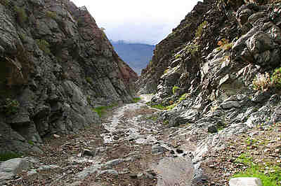
The path was similar to the previous days’ journey in the Wash, with varying space between the mirrors and the steep walls of the canyon.  There were a couple of times when I had to pull in the wing mirror on one side or the other because the trail hugged the wall with a deep drop-off or rough passage on the other side.
Goler Wash - Coyote Canyon Rd.

[Thanks to David A. Wright for alerting me that the previous pic is in a section further Westward than I thought.  The image is actually down near the mouth of Goler Wash, below the Newman cabin.]

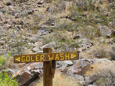
At around 2 mi. East of the Newman Cabin, for some forgotten reason, we took a right turn onto an inviting trail.  There were no signposts with directions (as there seems to be now)…

Goler Wash sign.
…so on a whim (…interestingly, also known as ‘a vertical horse-powered drum used as a hoist in a mine’.) we drove up this trail towards who-knows-what!
Some of you readers might actually know where we were heading, but please remember (again) that we had absolutely no clue where we were, where we were heading, what the terrain was like, what the roadway was like, no map, no GPS, no cell phone, no knowledgeable travelling mates — N O T H I N G !
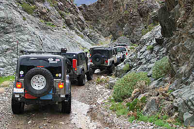
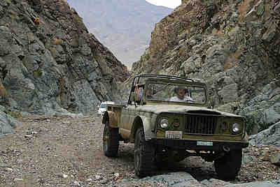
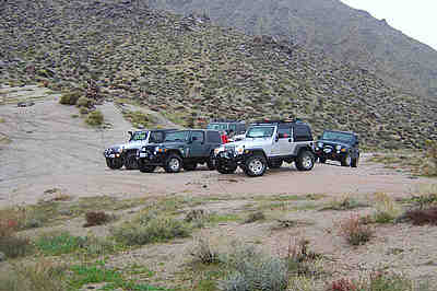
I’ve seen the pictures all over the Web with convoys of well-equipped, heavy-duty, 4-wheel drive on/off-road vehicles, giant rock-crawling tires, with license plates such as “DV GHOST” (Death Valley Ghost), “DV RUBCN” (Death Valley [Jeep] Rubicon), with winches, tow-hitch points, problem-spotters and helpers, and probably a big tow truck and a  medi-vac helicopter hovering somewhere close, ‘in case’!
Aw-right... what's the holdup here? There's never a cop when you need one!
There are 7 vehicles in this shot, and a couple of them have intake snorkels for driving in deep water!
…and look at THIS machine!  That green bumper sticker says, “TREEHUGGER”!!  …see any trees here?
You could climb up the canyon walls with this baby!
…and the white vehicle following this one.  Is the a/c on?  Do they get FM reception here?
Don’t get angry with me, all you off-roaders.  I’m jes’ funnin’ with ya again!  I’d do it in a heartbeat if we lived where we did back then!  I wonder if my ’98 Dodge RAM quad-cab, 2-wheel drive would be able to make that trip today.  I DOUBT IT!
…or WOULD IT??
[Okay, back to the story…]
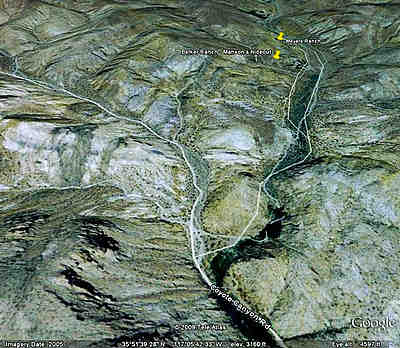
Goler Wash to Barker Ranch
So, we turned off Coyote Canyon Rd. and drove for another mile or so, when we came upon a house surrounded with a barb-wire fence, with an old school bus, Dodge Power Wagon, a few old house trailers and a couple of flatbed trailers, several dogs and some farm animals we could hear from a pen on the side.
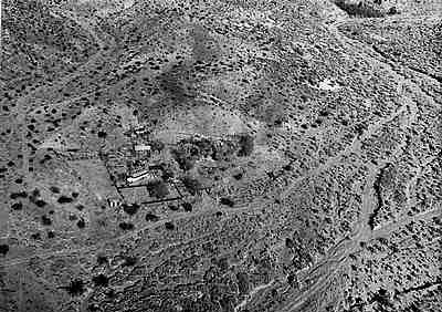
Barker Ranch- old aerial view, maybe surveillance photo.
I stopped on the pathway in front of the gate, instructing Barbara and Danny to be watchful and quiet while I approached and shouted to the house.  Not worried, just cautious.  We didn’t know AT ALL that it was the notorious Barker Ranch, aka ‘Charles  Manson Family hideaway’! (hence, the name of this story!)
When I got to the high barb-wire gate at the wooden arch (clearly visible in the photo above) I shouted, “Hello, the house!”  Several dogs ran to the gate, and were barking and wagging, but I kept back a bit anyway.  Finally a long-bearded guy came out and down to the gate to talk to me.  He was absolutely friendly.
I asked him about the road ahead, and he said it went nowhere.  He told me the best way to go would be to go back to Coyote Canyon Rd., then turn right (North-East) and go on that way.  We would come to a cairn at the top of a rise.  We should go down the other side, past the Striped Butte, and then when the trail got to the center of that valley, to go to the right (East on Butte Valley Rd.), and follow that past the talc mines and down into Death Valley.
He then added this caution; he said that last night it had rained down below, and there would be sand and maybe some water covering the trail where it hits the Death Valley floor.  He cautioned me to NOT cross this, as it would be like quicksand, but we should wait overnight, if necessary, and the Army Corps. of Engineers would be sending a grader to clear the way for the talc mine trucks early on Monday morning.
I shook his hand and thanked him for his advice and help, and headed back to the van.  I remember him smiling and waving to Barbara and Danny in the van.
Who was he?  …ABSOLUTELY no idea!  But many years later, when I was idly looking at my ‘new’ program, Google Earth, and eventually deciding to have a look at where we went on that trip…
THAT’S when I learned about the Manson Hideaway!  WOW! *slapping my forehead*
Okay, so Manson and Family were arrested on August 16, 1969 at the Barker Ranch.
 
Arrested August 16, 1969 at The Barker Ranch.
.
.
           …and then there was me…...NEVER arrested!


==================================
Here’s a wikipedia.com description of the hideout: In the first days of November 1968, Manson established the Family at alternative headquarters in Death Valley’s environs, where they occupied two unused or little-used ranches, Myers and Barker. The former, to which the group had initially headed, was owned by the grandmother of a new woman in the Family.  The latter was owned by an elderly, local woman to whom Manson presented himself and a male Family member as musicians in need of a place congenial to their work.  When the woman agreed to let them stay there if they’d fix up things, Manson honored her with one of the Beach Boys’ gold records, several of which he’d been given by Dennis Wilson.
Here is a video I just found of a trip up through Goler Wash, going to Manson’s hideout.  It is pretty well done for an amateur video.  I think it was shot around March, 2006.
https://www.youtube.com/watch?v=4qvYIOUq71Q

Here is a description of this video: **Featuring actual Charles Manson recordings & his music, including the song “Arkansas” as well as recordings of the “Manson Girls”.
Hidden in a remote gold mining canyon, high above Death Valley, in the desolate Panamint Mountains of California, is the last hideout of infamous cult killer Charles Manson & his young followers known as the Manson Girls.   Barker Ranch still stands today, abandoned & left to the elements, only a few hardy & prepared travelers can make the arduous journey through the uninhabited Panamint Valley and into Goler Canyon where Charles Manson and his “family” of young killers hid out after the brutal murders of actress Sharon Tate, the LaBianca family, and other unfortunate people who the “Manson Family” encountered during the summer of 1969.  For several months after the Los Angeles area murders Charles Manson and his followers roamed the hills and valleys around Death Valley & dropped acid in the grungy confines of Barker Ranch.  By December of 1969 the Inyo County police tracked the “Manson Family” down and found Charles Manson cowering under the bathroom sink of Barker Ranch.  We followed the “Manson Family’s” steps from the San Fernando Valley to Trona Pinnacles & Goler Canyon high above Death Valley.  It was easy to sense what these young killers must have felt as they struggled to get their old school bus up rugged Goler Canyon …just as we struggled to get my stock Jeep Cherokee 4×4 up the same canyon.   Wandering through the still furnished rooms of Barker Ranch and imagining the Manson girls singing hippy folk songs left us with a very creepy feeling.  We found the old bathroom where Manson hid from the police and recorded the entire premises around Barker Ranch.  I managed to get actual audio recordings of Charles Manson, including songs from his 1968 LP ‘LIE’, which I’ve included in this short film of our journey in search of Manson’s last hideout.  If you are a fan of the macabre or crime history you will be fascinated.  This is our story about Finding Goler!  Also featuring the music of Tricky, The Goodlookins’, Johnny Cash, Rolling Stones, Jimi Hendrix & Jim Morrison, Portis Head, the Mason Family Girls, etc.
================================================================
*WOW*
=======================
Charlie Manson and Me – part 5
~Goler Wash to Mengel Pass~
=======================

Charlie Manson and Me – part 6

Filed under: Charlie Manson and Me - part 6 — Tags: — Bob @ 4:23 pm

=======================

Charlie Manson and Me – part 6

~Carl Mengel Pass~

=======================

Well, we drove on with great hope of what we might see around the next bend.  This was the BEST thing about what we were doing and where we were!  

…A D V E N T U R E !

We drove along, still on Coyote Canyon Rd., for about 3.5 mi. before coming to our next great hurdle.  The trail was fairly smooth and sandy with only a few tracks visible; dirt-bike and horse tracks, no other 4-wheeled vehicles, as I mentioned earlier.

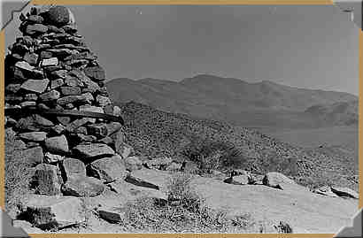
It was a beautiful morning and we were soaking in this unbelievable scenery as we made our way towards the cairn that our ‘mysterious guide’ told us about.  Honestly, I wasn’t even sure what a ‘cairn’ was!  I knew it was some sort of marker, but I didn’t know it was a burial marker.

[David A. Wright:  A cairn was often used for marking mining claims.  When a claim covered a large plot of ground, generally a cairn was built in each corner of the plot.  On smaller claims, one often sufficed.  In the case of Mengel’s grave, the term is applicable, as the shape of rocks piled up into a cylindrical or conical shape is that typical of stone cairns.]

So, (singing) ‘Merrily, we roll along, roll along, roll a-loooong…’

Approaching Mengel Pass - 1976

Approaching Mengel Pass – 10/1976

Approaching Mengel Pass-2 - 10/1976

Approaching Mengel Pass-2 – 10/1976

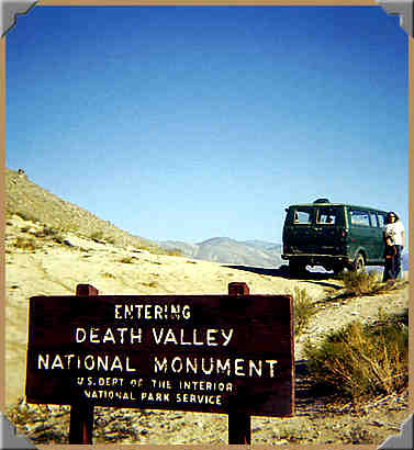
…and then, out of nowhere, a sign of civilization??

Approaching Mengel Pass-3 - 10/1976

Approaching Mengel Pass-3 – 10/1976

…get it?  …a ‘SIGN‘?

(c’mon, Folks, these are the JOKES!  SHEESH!  What a rough crowd!)

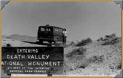
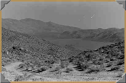
Here it is in b/w - nearing Mengel Pass - 10/1976.

Here it is in b/w – nearing Mengel Pass – 10/1976.

WOW!  Were WE surprised to see this sign out here!  Not that the words “D E A T H  V A L L E Y” didn’t give us a scare!  We knew we were close to it from looking at our roadmap, but who’da thunk WE would ever be entering Death Valley from a remote side-entrance like THIS!!  …WOW!

Mengel Pass - West side approach - 04/04/2008

Mengel Pass – West side approach – 04/04/2008

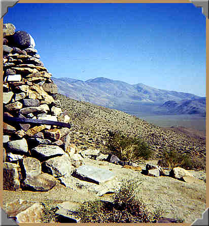
So once we drove up the long and kinda steep approach to Carl Mengel’s cairn, we stopped to pay respects, and take a couple of pictures from this beautiful elevation.

Carl Mengel cairn, looking Eastward into Striped Butte Valley - 10/1976

Carl Mengel cairn, looking Eastward into Striped Butte Valley – 10/1976

At Mengel Pass looking into Striped Butte Valley - 10/1976.

At Mengel Pass looking into Striped Butte Valley – 10/1976.

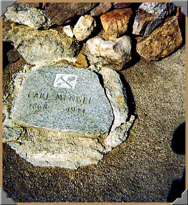
Of course, we didn’t have a clue who Carl Mengel was, or why he was buried here. 

"Carl Mengel - 1868 - 1944"

Years later, I read that his ashes are here, and also his wooden leg.  I don’t know if there is a meaning to the steel ring, possibly a wheel rim.  Based on more recent pictures, people have taken to placing coins on the stone plaque.     

Also, there is now a ‘parking area’ to leave your vehicle and walk over to the cairn.  There is also a trail that goes to the top of a high rise nearby, but I don’t think that was there when we were there, although it may have been just too steep and high for us to even consider attempting.      

Carl Mengel Pass - parking.

Carl Mengel Pass – parking.

Valet parking is available from 10:00 am to 5:30 pm on weekends, only!  *wink*

So, now our attention turns Eastward again, looking toward Striped Butte Valley, mentioned earlier by our tour guide at the Barker Ranch. 

Looking East into Striped Butte Valley - 10/1976

Looking East into Striped Butte Valley – 10/1976

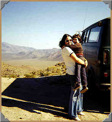
…nice ‘bells’ there, Barb!  Remember bell-bottom pants?  Oh, wait!  They made a come-back already!  LOL

Looking East into Striped Butte Valley - 10/1976

Looking East into Striped Butte Valley – 10/1976

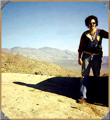
See, all you ‘Doubting Thomases’?  We WERE there, and our ol’ van DID make it!!  Notice my 35mm-slr slung across my chest, with the lens cap ON!!  I  actually did take a few pics up there!  I obviously left my ‘fro-pik’ at home!  LOL  C’mon!  It was the SEVENTIES!     

We bid a fond farewell to Mr. Mengel and continued our Eastward trek.  Just beyond the cairn the trail dropped away into Striped Butte Valley.  I slowly edged the van down over the top of the very steep and rocky decline.  Mostly, gravity urged us along, with the occasional help of the engine to climb over a boulder.

The trail down into Striped Butte Valley - 10/1976.

The trail down into Striped Butte Valley – 10/1976

(Please excuse the scratches on the print.  The negative was a bit damaged.)

In this old picture the trail down looks fairly smooth at this point, but I have seen later pictures of how it has changed since then.  It is VERY rough a bit farther down. 

About three slow and very bumpy minutes down the grade I stopped to cool and rest the brakes (4-wheel drums, no discs here!), and my nerves, and upon looking back up to where we had just started, I concluded that there was absolutely and positively (or was thatNEGATIVELY?) no way in or out of HELL that this old van could EVER get back up to the top, short of establishing a camp down below, and with the aid of my trusty shovel and prybar, construct an earthen ramp starting at the base of this incline and finishing at the top, that would end up being about 1/4-mile long, and would take about 10 years to complete!

(How’s THAT for a run-on sentence?  LOL)

I refrained from mentioning this new-found information to Barbara, as it would certainly add to her concerns for our safety, and also add to her questions about what we would be doing Monday morning; getting ready to go to work and school, or hunting for desert rats and snakes for breakfast stew! 

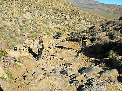
Again, *smack-my-head* no pics of my own (…’cause I was busy hanging on to the steering wheel and fighting to keep us from getting hung up on those big rocks and doing irreparable damage to the van!), but TONS of off-roading folks remark that this is a VERY rough stretch of bad road, mostly with excitement, as they can test their rock crawlers, dune buggys, tricked-out off-roaders and shiny new Hummers! 

 
Mengel Pass - East side

Mengel Pass – East side

That pic shows MUCH more sand filling in the gaps than there was in 1976!

Mengel Pass - East side - 01/08/2008

Mengel Pass – East side – 01/08/2008

Yeah, I’m guessing he’s having that same feeling I got when I looked back up that hill!  *GULP!* 

 
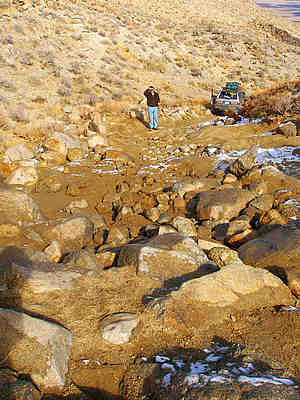
Mengel Pass - East side - looking West

Mengel Pass – East side – looking West

Yup!  MUCH more sand than when we were there!  Looks easier now!  LOL  (Ya, SUUURE!)

…did we drive down stuff like that??  Yep!

=========================

Charlie Manson and Me – part 7

~Striped Butte Valley~

=========================

June 22, 2009

Charlie Manson and Me – part 5

Filed under: Charlie Manson and Me - part 5 — Tags: — Bob @ 9:19 am